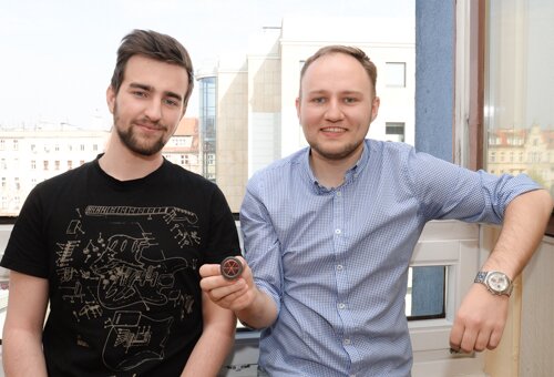
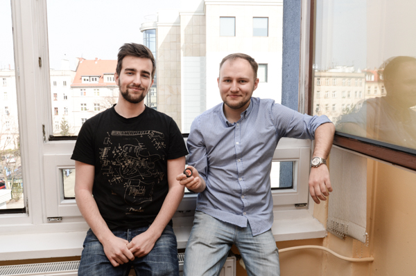
The success of our geodesists: Dr. hab. Krzysztof Sośnica and his MSc student Radosław Zajdel. We have become official ILRS Associate Analysis Centre.
– Among navigation systems we know there is the well-known American GPS, used daily by a great number of people, but also others such as Russian GLONASS – fully operational since 2010. Next systems are now being built: the European Galileo, the Chinese BeiDou, i.e. Ursa Major and the Japanese QZSS, which facilitates positioning among high buildings common in this country – explains Krzysztof Sośnica and adds that these navigation systems partly complement one another. And they have something which GPS does not – every satellite is equipped with a retroreflector consisting of about 60 to 80 prisms reflecting laser light.
– And if we look into the prism, we will always see the middle of the left or right eye pupil, depending which eye we are looking with. The prism reflects light, also laser light exactly in the same direction in which laser beam goes. New systems, like the European Galileo, Russian GLONASS or Chinese BeiDou, have been equipped with retroreflectors for laser ranging with millimetre precision – explains Sośnica and reveals the reason for our geodesists’ success. – Currently few people are able to process laser and microwave observations of new satellite systems because the European, Chinese or Japanese systems are not fully operational yet. At the Wrocław University of Environmental and Life Sciences we have set up a centre which analyses laser distance ranging for new navigation systems.
Dr. hab. Krzysztof Sośnica and his MSc student Radosław Zajdel are proud that they found themselves on the NASA sites.
In Wrocław, thanks to specially designed calculation schemes based on modified Bernese GNSS Software, solutions based on microwave signals (sent by a satellite) are compared with laser measurements carried out by independent ground stations. Thanks to the calculations we can learn how coherent the microwave and laser techniques are, taking advantage of what is best in both of them.
Microwave and laser signal between the station on earth and an orbiting satellite runs 20-40 thousand kilometres, passes through different atmospheric layers and is influenced by many interfering factors.
We show how important in current research is an integration of two independent techniques – although each of them is influenced by different interferences – explain Krzysztof Sośnica and Radosław Zajdel – Sośnica’s student who created calculation schemes and a programme for interactive visualisation of the analyses.
As the scientists explain, one more factor is taken into account when data is analysed: satellite orbits, i.e. the routes which the satellites take. Artificial satellites’ orbits are determined with only limited precision as they are fitted with big solar panels which are influenced by solar pressure interfering with their established route.
– We examine, for example, position of satellites in reference to the location of the Sun, how high the Sun is in relation to the orbit surface, where the satellite is from the perspective of an observer on Earth and how the transmitting aerials on the satellite are oriented as well as the outer solar panels, and how it influences the precision of determining the satellite position - say our researchers.
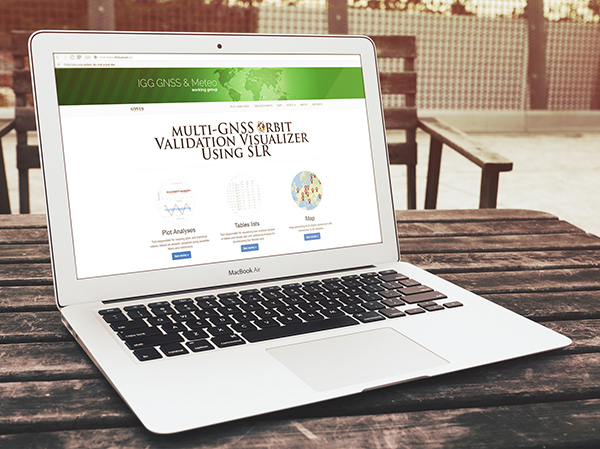
The website was set up as a part of Radosław Zajdel’s MSc thesis. Initially, the idea was to analyse historical laser data but as the information was being gathered, the subject grew larger. Invaluable was the help of the supervisor and many members of the institute and doctoral students, who suggested further area of research, which eventually led to setting up a service for visualising and analysing the data.
Thanks to the website, anyone in any part of the globe may open a suitable module and carry out the analysis.
Thanks to the website, anyone in any part of the globe may open a suitable module and carry out the analysis.
New data is calculated once a day and the large number of hits on the website from all over the world proves its popularity and usefulness. Currently we are visited by users from Australia, the USA, China, Peru, South Africa, Namibia, South Korea or Brazil. – says Zajdel.
The Wrocław-created website qualified thanks to its uniqueness. At UPWr, we process satellite observations of new systems and deliver operation products, so, to a certain extent, we do something that nobody else does.
The website created at the Wrocław University of Environmental and Life Sciences is visited by users from Australia, South Africa, the USA, Brazil etc.
The data from our service is used by, for example, users of navigation systems. The aim is to measure with a down-to-the-millimetre precision. It’s important because, for example, surveyors who are carrying out measurements and want to use the new satellite systems like Galileo, can check if the satellite has not indicated any errors in its functioning. It can also check, whether the satellite orbit has not been erratic in any period which could adversely influence the determination of its position on earth. Precise positioning has enormous significance not only in navigation but also, to give just one example, in monitoring the increase of sea and ocean levels, caused by melting glaciers.
Reference points have a pivotal role in geodesy. At present, various techniques do not give us internal coherence or down-to-a-millimetre precision. If we compare two independent techniques such as a microwave or a laser one, it turns out that the differences in position sometimes exceed even 1 cm. In monitoring the oceans and seas, however, these several millimetres or a centimetre make a huge difference. That’s why, in geodesy we must pursue a down-to-the-millimetre coherence between different observation techniques and as well as reference point precision.
The Wrocław website has been incorporated into an international network by the observation service operating under the auspices of the International Association of Geodesy. The International Laser Ranging Service (ILRS) includes also associated analyses centres, however, in order to become its member, stringent criteria have to be met, such as providing operational calculation products.
In our case it all started with an idea for a service. I worked on the software and with every passing month it turned out that new functions ca be added and the system may work better. When we got the information that the ILRS service accepted it as an official analysis centre, our joy was enormous. It’s a great success – says Radosław Zajdel and admits that finding oneself on NASA websites only whets one’s appetite and motivates to work harder. – I have been programming all my life but I never wanted to work as a programmer. I took interest in scientific fields where programming skills were an additional trump card. And that’s how I came across dr. hab. Krzysztof Sośnica. Radek says that he is already planning his doctoral thesis and adds with a smile that he would like to tap into the knowledge and experience of his supervisor, who received his academic degree before he was thirty.
– The key to success is teamwork, discussions, conversations, joint analysis of different problems and phenomena. I organize MSc and PhD workshops where master and doctoral students sit down together, present the stages of their work and debate. In today’s scientific world individualism is less likely to succeed. Teamwork and brainstorm – this is a recipe for success – adds dr. hab. Krzysztof Sośnica.
This site uses custom cookies to ensure that it functions properly. Some are necessary for the page to run, so will always remain active. These cookies will store information about the user's cookie settings. In addition, third-party cookies are used for external tools. For more information see the privacy policy.
Purpose
Enables storage (such as cookies) related to advertising.
Agreed
Sets consent for sending user data to Google for online advertising purposes.
Agreed
Sets consent for personalized advertising.
Agreed
Enables storage, such as cookies (web) or device identifiers (apps), related to analytics, for example, visit duration.
Agreed
Enables storage that supports the functionality of the website or app, for example, language settings
Agreed
Enables storage related to personalization, for example, video recommendations
Agreed
Enables storage related to security such as authentication functionality, fraud prevention, and other user protection