
The First Pole in the Management Board of ILRS
The International Laser Ranging Service (ILRS) has completed the selection to its Governing Board for the 2019-2020 term. Professor Krzysztof Sośnica has become one of the two Board Appointed Representatives
You have become a member of The International Laser Ranging Service Governing Board. What does this service deal with?
It has real influence on the development directions of laser surveys to artificial satellites and the Moon and on the strategy of development of satellite geodesy in the global perspective.

You are the first and, so far, the only Polish representative who belongs to the Governing Board of ILRS/NASA. I should, therefore, ask you about your satisfaction.
I would rather talk about pride, distinction and, of course, years of hard work which has borne fruit. My appointment is a cause of great joy not only for me but also, I think, for all people in Poland involved with Polish satellite geodesy. However, it also means obligation and awareness of the challenges ahead of us. While congratulating me, the Chairman of the Board added that I’m also the youngest member in the Board’s history.
What does ILRS do?
The history of laser measurement is inextricably linked with the history of space exploration and first satellite missions. In 1957, the first Russian satellite Sputnik 1 was launched into space followed by the first American satellite – Explorer 1. In order to use artificial satellites for military, scientific and navigational purposes, it was necessary to know the satellite’s orbit, that is the coordinates of its position in time. First such coordinates were determined on the basis of optical observations, with the use of telescopes or by photographing traces of satellites against the background of stars. Those methods allowed people to determine the orbit with an accuracy of several hundred metres because the photographs did not show distance i.e. the radial component of an orbit. At the same time a new invention was being developed – laser, which is nothing else than ordered light of predetermined wavelength, direction and polarization. It was then decided to use it for distance measurement.
How was it done?
Special prisms were needed, which reflected laser light in the same direction as the beam. The first satellite on the orbit which was equipped with such prisms was Explorer 22, launched in 1964. The surveys made in the NASA Goddard observatory went far beyond expectations because the precision of distance measurement was below 1 metre. This led to the installation of prisms on many satellites. Finally, in 1969, the Apollo 11 mission took laser prisms and installed them on the Moon surface. The first ones were so precise that it was necessary to redefine the common roots of the Moon and the Earth.
What else has been learnt thanks to those measurements?
It was discovered that the Moon moves away from the Earth by 38 mm per year and that it used to be much nearer, which made the Earth’s day much shorter. So far, three American reflectors have been placed on the Moon – Apollo 11, 14, 15 and two on autonomic Soviet rovers Luna 17 and 21.
What have satellite surveys given us?
In the 1970s, when the GPS system did not exist yet, laser observations together with Very Long Baseline Interferometry made it possible to confirm the theory of continental drift of up to a dozen or so centimetres per year, as well as to determine approximate borders of tectonic plates. All over the world laser observatories began to appear performing laser measurements of distances to artificial satellites and the Moon. Currently there are about 50 observatories in operation which are members of the ILRS. The only laser observatory in Poland, in Borowiec near Poznań, started surveys in 1976 and still performs millimetre-precise measurements to satellites and, recently, also to space junk.
What scientific significance do these surveys have?
The ILRS includes not only laser observatories from every part of the globe but also centres of processing distance surveys to satellites and the Moon. Thus, it provides fundamental observations and products used in different areas of satellite geodesy, physics, astronomy, geophysics, Earth sciences and environmental sciences. SLR laser technology is used for creating global geodesic reference systems providing the most precise information on the location of the centre of Earth mass, a so-called geo-centre which usually serves as the beginning of global reference systems. No other technique allows us to credibly determine the centre of the Earth. Measuring distances to satellites and observing their movement we can determine the Earth centre down to a fraction of a millimetre. The scale of the system in the laser technology connects the length scale (definition of metre linked to the speed of light) with the dynamic scale (gravitational constant affecting the average movement of satellites) and with time scale (through the link with universal time and definition of second). Moreover, laser observations make it possible to determine the parameter of Earth flattening, gravitational constant, geoid shape, daily coordinates of Earth pole and changes in day length. And finally the laser surveys are used for the calibration of sensors in altimetric satellites which are used for measuring changes of water levels in seas and oceans, determining precise orbits of geodesic, remote-sensing and navigation satellites, time transfer and quant communication and for verifying the results of the general relativity theory, such as the Lens-Thirring effect, Einstein’s equivalence theory and gravitational redshift.
A film showing a laser station in Zimmerwald in Switzerland run by the Institute of Astronomy in Bern,
where Krzysztof Sośnica worked and defended his doctoral dissertation
What does the Board, you are a member of, deal with?
All activities regarding laser surveys and determining scientific products based on these observations are coordinated by the ILRS. The development strategy and ILRS activities are coordinated by the Governing Board. The Board also defines standards and procedures of laser measurements, accepts satellite positioning missions and sets priorities in providing official scientific products.
What does its selection look like?
The process of selecting the members of this 18-person body is multistage. The chairman of the Board is professor Michael Pearlman from the Astrophysical Centre at Harvard. The Headquarters of the ILRS is based at the NASA’s Goddard Space Flight Centre near Washington.
And it’s the first time a person from Poland has become a member.
I was chosen as an “appointed member”, which means that I received one of two places granted through an appointment by the other members of the Board. My role will be, among other things, to coordinate cooperation between the ILRS and the International GNSS service in the areas of positioning and processing laser observations for new GNSS systems: Galileo, GLONASS, BDS, QZSS, GPS Block III, as well as the integration of laser and microwave observations onboard navigation and remote-sensing satellites and research on creating global reference systems with the use of passive and active satellites.
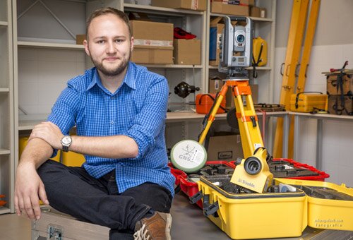
Krzysztof Sośnica
Heads the ILRS Associated Analysis Centre (at the UPWr Institute of Geodesy and Geoinformatics) and has many academic achievements in the field of the integration of observations coming from different geodesic surveying techniques, and particularly processing laser observations to GNSS, geodesic and remote-sensing satellites.


