Research on satellite observations – one signal, many applications
Adam Cegła, a PhD student at the Doctoral School of the Wrocław University of Environmental and Life Sciences, is working on a model that will combine two types of satellite observations. His research is to help investigate low parts of the atmosphere.
Adam became interested in geodesy while still in high school, when inspired by a teacher he became fond of geography and Earth sciences. He then started studying geodesy at the Wrocław University of Technology, and today he is doing a PhD in three-dimensional integrated observations of the atmosphere with the use of ground and satellite GNSS stations at the Doctoral School of the Wrocław University of Environmental and Life Sciences.
– During my studies I found that the prospects for studying surveying at the UPWr are better, which is why I moved. Here at the University, I came across Professor Rohm, who is my supervisor. He suggested I choose the topic of atmospheric tomography. We worked on a lot of joint projects during my master's studies. For example, together we investigated whether it is possible to show, by means of refraction, that there is volcanic ash in the air after an eruption. My thesis came third in a national competition for the best master's degrees in geodesy and cartography organised by the Association of Polish Surveyors. Based on this we published an article, and the Professor offered me a doctorate as an extension of our research – says doctoral student Adam Cegła, explaining that their work on measuring the concentration of volcanic ash used GNSS receivers located around Sakurajima volcano in Japan to analyse the values of signal delay picked up from the satellites, and on this basis they deduced in which direction the cloud was spreading.
Such studies can help avoid multi-billion dollar losses in the future. It turns out, for example, that in the case of the Eyjafjallajökull volcano eruption in Iceland, shutting down air traffic was not necessary, because the dust concentration over Europe was low and did not endanger aircraft engines.
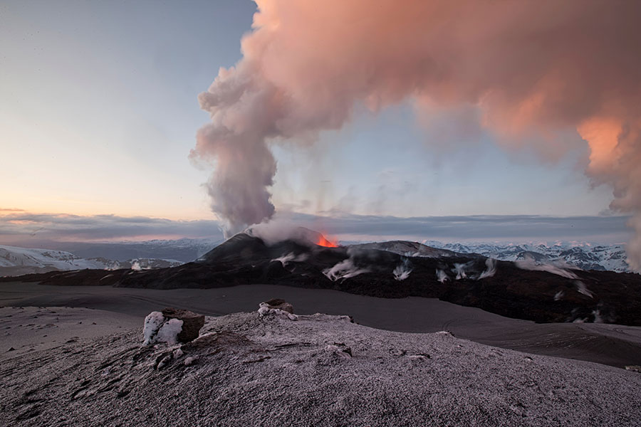
Dust concentration after the Eyjafjallajökull eruption in 2010 over Europe was so low that it did not endanger aircraft engines. Photo: Shutterstock
Tomography not only in medicine
Adam's current research concerns tomography of the atmosphere, i.e. analysis of the signal passing through the atmosphere. All signals sent from one satellite to another or from a satellite to a terrestrial receiver are disturbed. These disturbances, depending on air pressure and temperature, can be investigated and analysed. On this basis, the refractive index, i.e. the refraction of the ray, is calculated. As a result, the total delay of the signal can be calculated, i.e. the difference between the path that the signal travelled in a straight line if it had run without disturbance, and the one it actually travelled. On the basis of the refractive factor, one can estimate, among others, various weather conditions and help with weather forecasting.
– The advantage of this method is that it is much cheaper than the standard solution. Radiosounding and measurements from weather balloons are usually used to forecast the weather, and are very expensive methods. They cost anywhere from several to several hundred thousand zlotys. And additionally you need to spend a lot of time planning the measurements. However, in the case of atmospheric tomography, we use existing options, i.e. all GNSS receivers on Earth – explains the doctoral student, adding that in order to perform the tests they only need a computer and software that will be able to perform the correct calculations. This method lets them gain a dense data grid. Weather balloons are spaced far apart, while low-cost GNSS receivers can be placed at any distance – even every 2-3 km.
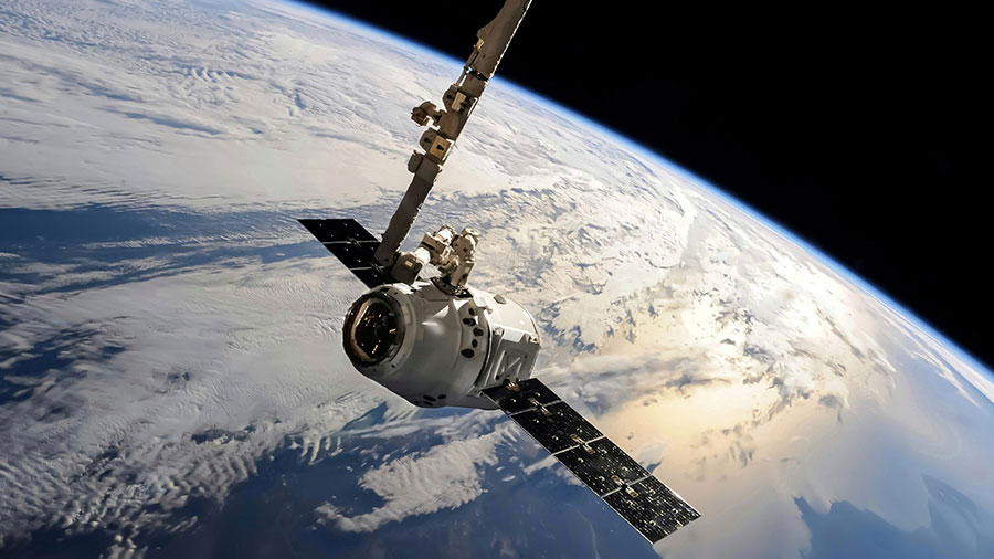
Adam wants to combine two types of satellite observations to study the lower parts of the atmosphere. Photo: Shutterstock
The closer we are to Earth, the less we know
At the Institute of Geodesy and Geoinformatics at the UPWr, a programme for testing the refractive index called TOMO has already been developed. It is used by various institutions for research. However, the solution used is not very precise in the lowest parts of the troposphere, at altitudes of 1-2 km. This atmospheric layer is the most volatile and needs a suitable solution to help analyse it better. With his scientific work, Adam Cegła is trying to further develop the existing solutions by adding measurements that will help to study these regions of the atmosphere.
– Such data can be provided, for example, by studying radiocultivation, which is simply a study of the signal going from one satellite in high orbit to another satellite in low orbit, which is broken due to many factors. When the second satellite is very low above the Earth's surface, the signal will be curved, letting us analyse it. Its results will allow us to draw conclusions about the values of refraction at low heights above the Earth's surface, and thus indirectly provide information about the temperature and pressure along the signal path. Similar assumptions have already been implemented by other research teams, but as far as I know, so far no one has managed to create a model that will combine two types of observations, i.e. those that run classically from a satellite to a receiver on Earth, and those running between two satellites – emphasises Adam. As expected, by combining both types of observations into one model it will be possible to obtain a more precise tropospheric model, resistant to various types of disturbances, such as sudden pressure changes or storms.
The PhD student at the UPWr Doctoral School also cooperates with Dr. Müller from the Swiss Federal University of Technology in Zurich, who supports him in his research by providing him with his version of the script for signal modification calculations and theoretical knowledge of signal propagation in the atmosphere. Next year, Adam intends to travel to Zurich again during the summer holidays to pursue a research plan.
Adam Cegła also works in the OPUS project of the National Science Centre, which is also funding his doctorate, and he is employed on the AZON project, where he is involved in similar research involving the calculation of refractive indexes for Poland on the basis of signals sent from satellites to terrestrial receivers. This data makes it possible, for example, to generate refractive maps, which will be useful for both students and meteorological institutions.
Privately, Adam enjoys travelling and hopes to return to volcanic ash research during his doctorate, although this time outside the university, for example in Taiwan, where this type of research is also carried out. Surveying is a dynamically developing field of science, which is why Adam, when asked about his plans for the future, is still balancing between the choice of professional work and a scientific career. Maybe he can combine them both?
This site uses custom cookies to ensure that it functions properly. Some are necessary for the page to run, so will always remain active. These cookies will store information about the user's cookie settings. In addition, third-party cookies are used for external tools. For more information see the privacy policy.
Purpose
Enables storage (such as cookies) related to advertising.
Agreed
Sets consent for sending user data to Google for online advertising purposes.
Agreed
Sets consent for personalized advertising.
Agreed
Enables storage, such as cookies (web) or device identifiers (apps), related to analytics, for example, visit duration.
Agreed
Enables storage that supports the functionality of the website or app, for example, language settings
Agreed
Enables storage related to personalization, for example, video recommendations
Agreed
Enables storage related to security such as authentication functionality, fraud prevention, and other user protection