More accurate measurements of the distance to satellites and the Moon
A recent discovery of scientists from the Wrocław University of Environmental and Life Sciences demonstrates that the current approach to correcting errors caused by laser beam delay in the atmosphere is flawed. They propose a completely new solution, allowing for more accurate observations of the shape of the Earth, the melting of glaciers and changes in ocean water levels.
Laser measurements are based on recording the time difference between the moment a laser pulse is sent at the station and the time the same pulse returns after being reflected by a retroreflector on a satellite or the moon. During the measurement, the laser beam passes through the Earth's atmosphere twice, where it is deflected and delayed. The technology of laser detectors enables an accuracy level of under one millimeter. However, errors in determining the delay of the laser beam in the atmosphere are much greater, constituting the main source of errors in laser measurements of the distance to satellites and the Moon.
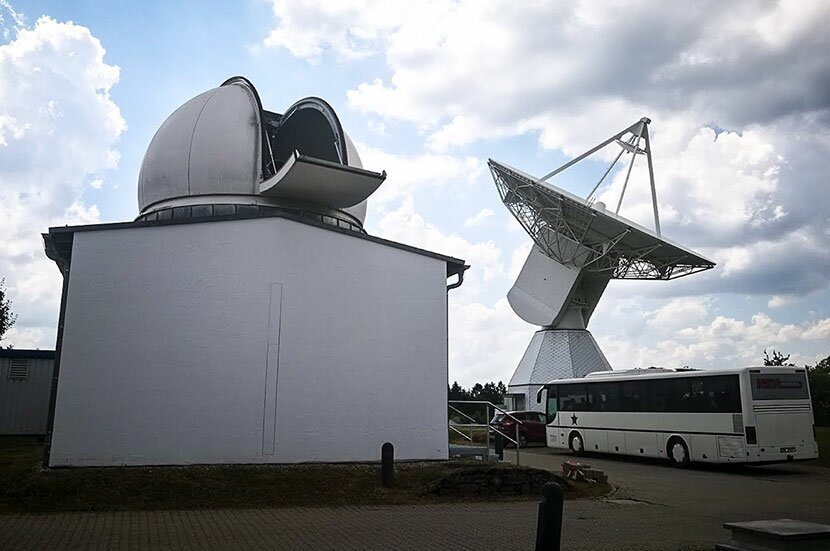
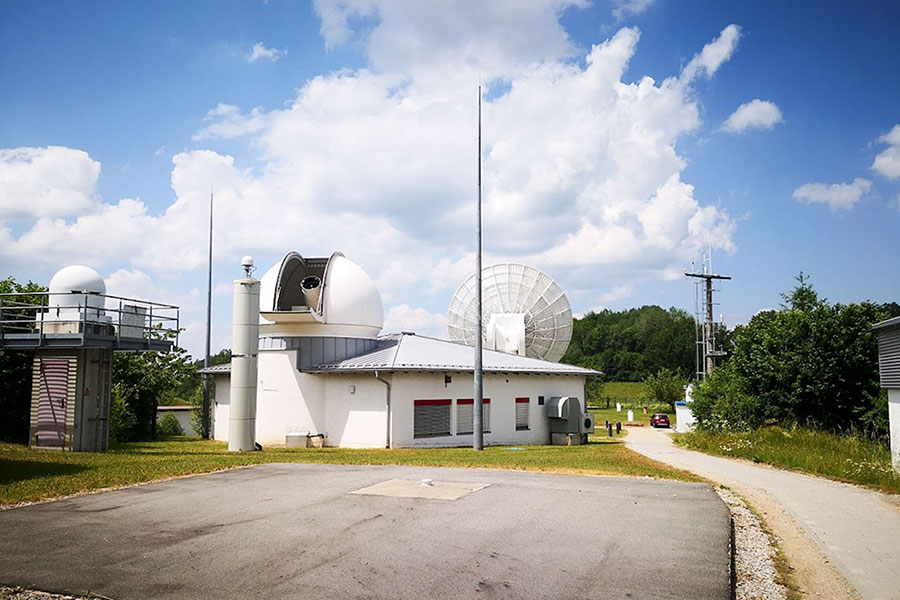
A weather station and antenna for multi-base interferometry at the Wettzell Geodetic Observatory Photo: Krzysztof Sośnica
Scientists from the Institute of Geodesy and Geoinformatics at the Wrocław University of Environmental and Life Sciences have proposed a completely new and innovative approach to correcting the delay of the laser beam in the atmosphere. The approach is based on measurements that take into account the thickness of the layers of the atmosphere through which the laser passes. The station’s meteorological readings are used to determine the laser delay value, for which the correction is calculated depending on the height of the satellite above the horizon and on the initial value of the delay of the laser beam.
As part of the proposed method, the measured distances at all stations are analysed and corrections are calculated for each station, which are directly proportional to the delay of the laser beam resulting from direct meteorological measurements and the thickness of the layers of the atmosphere through which the laser passes. It is enough to calculate the meteorological correction once a week for each laser station, thanks to which the calculations remain stable even for stations with a small number of recorded laser measurements of the distance to satellites, and at the same time the error resulting from the atmospheric delay is almost entirely removed. The method developed by the Polish team enables the elimination of 75 to 90% of systematic errors in laser measurements resulting from atmospheric delay errors.
This new method for reducing meteorological errors has a chance to become a standard method of laser measurements of the distance to satellites, and thanks to its simple and universal use, it will increase the accuracy even of historical observations of the moon and satellites. It also lets you detect incorrect barometer readings that negatively affected satellite observations of the Earth and the Moon in the past. This will improve both future and past observations of the shape of the Earth, so-called Earth bodies, changes in the Earth’s centre of mass and irregular circulation, and monitoring of the melting of glaciers and changes in ocean water levels.
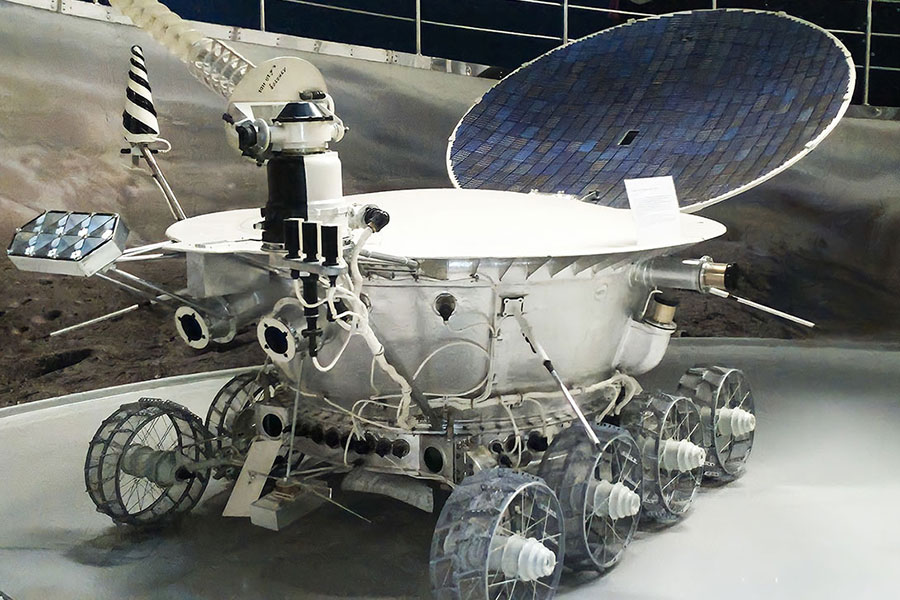
A replica of the lunar rover equipped with a retroreflector for laser measurements Photo: Krzysztof Sośnica
Laser measurements of artificial and natural Earth satellites have enabled the calculation of the gravitational constant and Earth’s mass, as well as by how much the Earth’s level has changed over time. We can now correct and calculate position adjustments of the Galileo and GLONASS satellites, and we have identified where the Earth's centre of mass is and its movements in time due to the melting of glaciers in Greenland. Laser measurements of the distance to the Moon have revealed that the Moon is moving away from Earth at a rate of 3.8 cm per year. They have also made it possible to accurately describe the fluctuations in the movement of the Moon called librations and review its origin.
The research group led by Professor Krzysztof Sośnica has for many years been dealing with the development of laser and microwave technologies in satellite geodesy, as well as with determining the exact orbits of artificial satellites and parameters describing the Earth. At the Institute of Geodesy and Geoinformatics of the Wrocław University of Environmental and Life Sciences, an Associated Analysis Centre of the International Laser Ranging Service (ILRS) for Artificial Satellites and the Moon has been operating since 2017. The centre is responsible for monitoring the quality of the orbits of satellites of the Global Navigation Satellite System (GNSS): Galileo, GLONASS, BeiDou and QZSS with the use of orbits based on microwave observations and direct laser measurements. The centre in Wrocław is the only one in the world that specialises in combining two observation techniques for artificial satellites: laser and microwave GNSS.
This site uses custom cookies to ensure that it functions properly. Some are necessary for the page to run, so will always remain active. These cookies will store information about the user's cookie settings. In addition, third-party cookies are used for external tools. For more information see the privacy policy.
Purpose
Enables storage (such as cookies) related to advertising.
Agreed
Sets consent for sending user data to Google for online advertising purposes.
Agreed
Sets consent for personalized advertising.
Agreed
Enables storage, such as cookies (web) or device identifiers (apps), related to analytics, for example, visit duration.
Agreed
Enables storage that supports the functionality of the website or app, for example, language settings
Agreed
Enables storage related to personalization, for example, video recommendations
Agreed
Enables storage related to security such as authentication functionality, fraud prevention, and other user protection