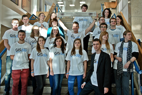
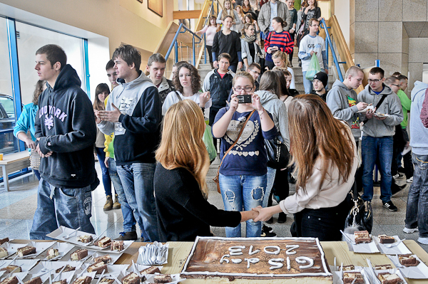
On 25 November over 450 people participated in GIS Day at the University of Environmental and Life Sciences in Wrocław – an event gathering users of geographic information systems (GIS).
There were also students from schools located in Wrocław, Oborniki Śląskie, Ostrów Wielkopolski and Zielona Góra, as well as students and workers from the Wrocław University of Environmental and Life Sciences.
– We use different solutions based on GIS systems every day. I hope that most of you gathered in this lecture hall, after learning about the cutting-edge technologies applied in geoinformatics, will choose to study Geodesy and Geoinformatics – said Professor Danuta Parylak, Vice-Rector for Student Affairs and Education.
fot. Mateusz Michalak
The lectures delivered by the invited speakers may certainly encourage students to study Geodesy and Geoinformatics. Karolina Bielińska from ESRI Polska presented a LiDAR project (Light Detection and Ranging). It is one of the most modern techniques of data gathering for a numerical terrain model. – Spaces modeled on the basis of cloud of points make up the future of Geodesy – she said. – They may be used for creating flood hazard maps. Thanks to their accuracy, we are able to analyze the surfaces of roads and the quality of overhead cables – added the representative of ESRI Polska.
fot. Tomasz Lewandowski
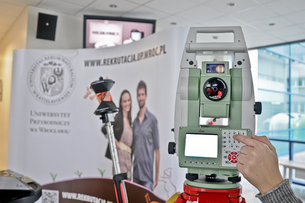
Tomasz Zieliński from Geotronix Polska presented a Trimble UX5 drone, an automatic low level aerial photogrammetry system. The device could be seen in the Teaching-Scientific Center, with Leica Geosystems and TPI instruments.
Also held during GIS Day were practical workshops, where students had a chance to learn about 3D modelling in SketchUp, GIS spatial analyses and ground-based laser scanning. During photogrammetry workshops they could learn about basic rules regarding digital photogrammetry and GIS software.
fot. Tomasz Lewandowski
GIS Day was prepared by the Student Geoinformatics Scientific Association, operating at the Faculty of Geodesy and Geoinformatics – the Faculty of Environmental Engineering and Geodesy, University of Environmental and Life Sciences. GIS Day was initiated and held under the patronage of the National Geographic Society. It has been celebrated globally since 1987 as part of Geography Awareness Week.
This site uses custom cookies to ensure that it functions properly. Some are necessary for the page to run, so will always remain active. These cookies will store information about the user's cookie settings. In addition, third-party cookies are used for external tools. For more information see the privacy policy.
Purpose
Enables storage (such as cookies) related to advertising.
Agreed
Sets consent for sending user data to Google for online advertising purposes.
Agreed
Sets consent for personalized advertising.
Agreed
Enables storage, such as cookies (web) or device identifiers (apps), related to analytics, for example, visit duration.
Agreed
Enables storage that supports the functionality of the website or app, for example, language settings
Agreed
Enables storage related to personalization, for example, video recommendations
Agreed
Enables storage related to security such as authentication functionality, fraud prevention, and other user protection